I work across disciplines to investigate how geomorphic processes and landforms influence critical zone (CZ) characteristics. Specifically, I use a variety of field techniques, laboratory methods, geospatial tools, and topographic analysis to quantify the connections between soil science, CZ characteristics, climate, and disturbances, to quantify interdisciplinary connections between geomorphic processes and carbon dynamics.
Geomorphic controls on the abundance and persistence of soil organic carbon pools in erosional landscapes
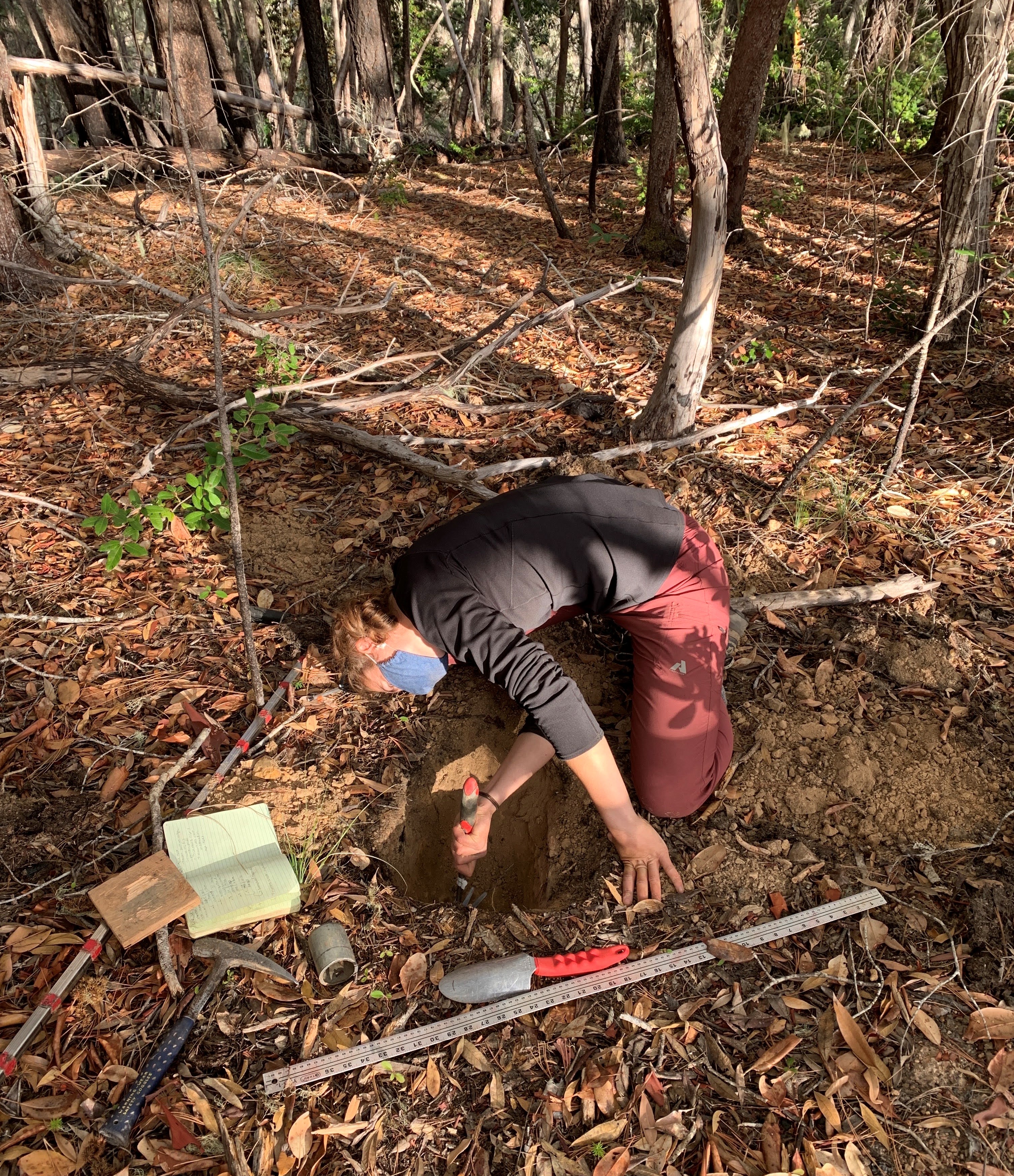
A large part of my field work involves spending time in soil pits. One of my field sites is located in Southern Oregon on Rabbit Mountain. In this field site I am investigating how a gradient of long-term erosion rates influence soil organic carbon storage. I describe soils in the field and then collect samples for soil analysis. Some of the analyses I do include soil texture, pH, carbon and nitrogen analyses and geochemical analysis with a portable XRF (pXRF).
Check out our recently published paper in Nature Geoscience to learn more! Hunter, B.D. et al. (2024).
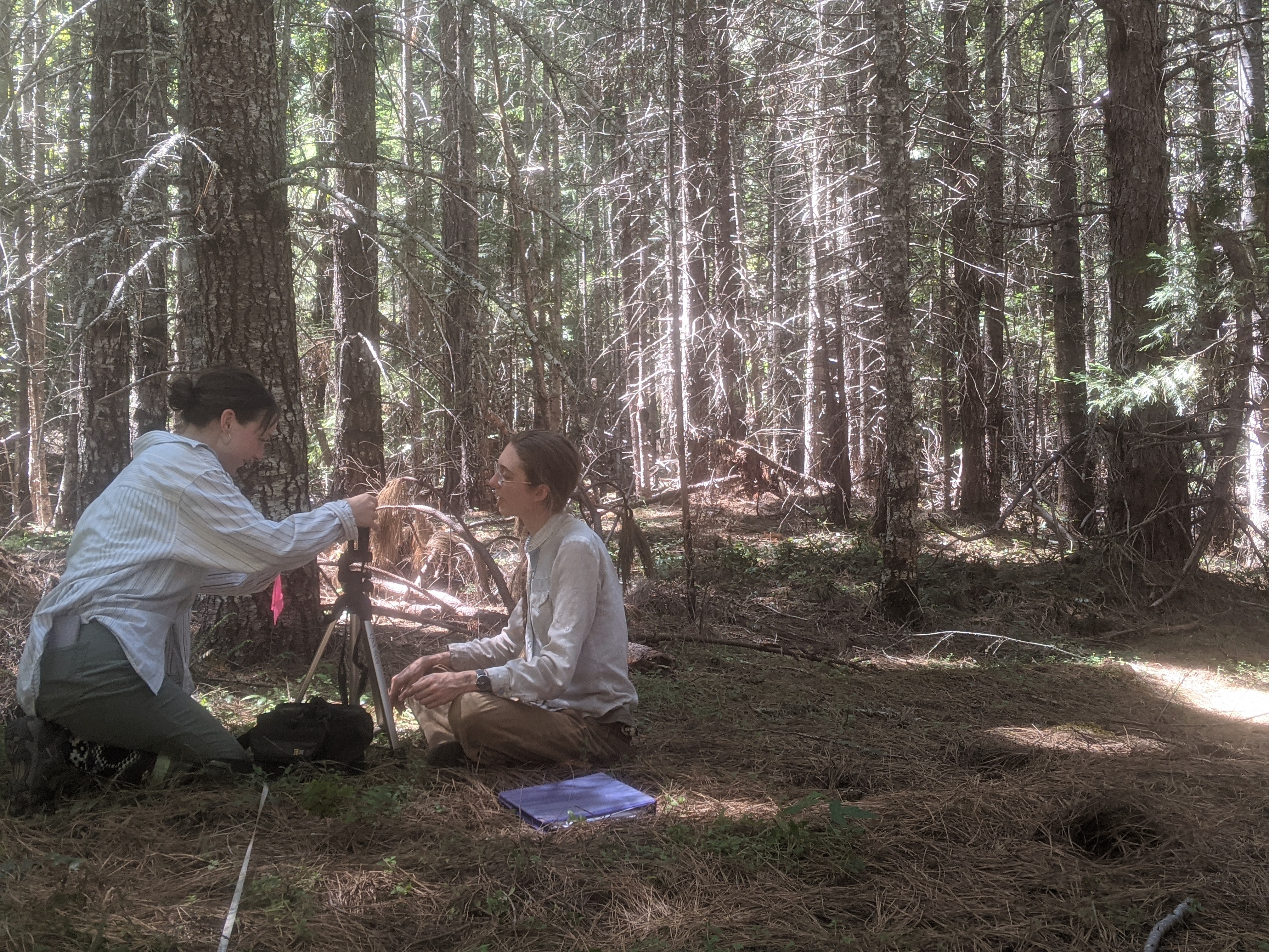
In collaboration with members of the SPA lab SPA lab, we conducted vegetation surveys. Undergraduate Delaney Kleiner in Biology and Environmental Sciences cores a tree while Biology PhD student Hilary Rose Dawson set up a camera for leaf area index photos along a line point intersect.
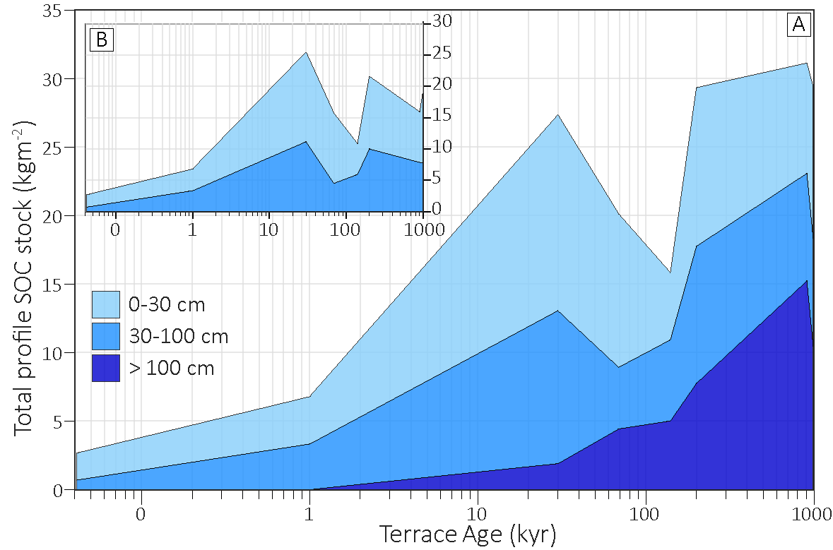
Using a landslide chronosequence to predict soil organic carbon (SOC) across the Oregon Coast Range (OCR)
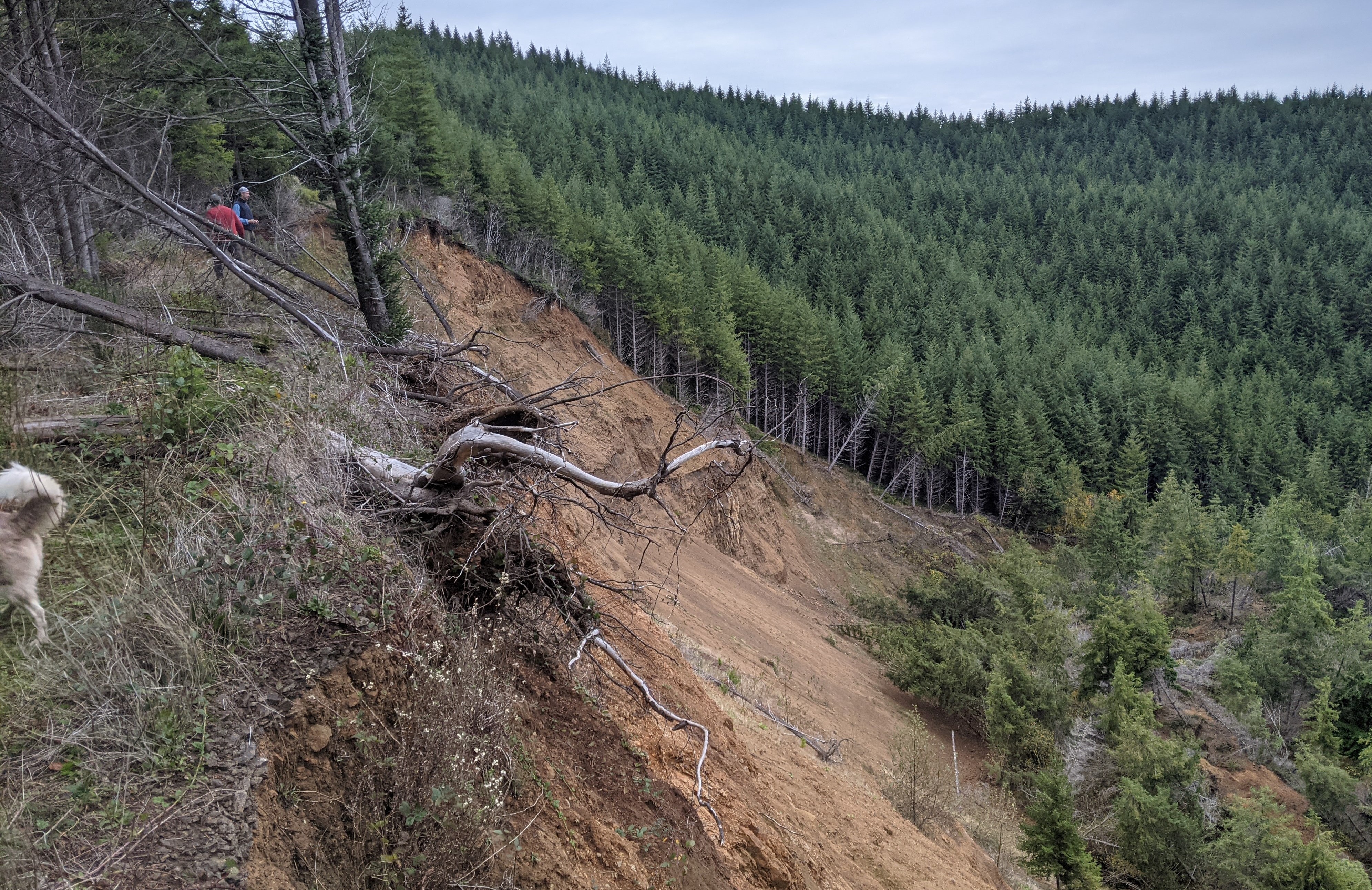
I am also looking at how landform age of deep-seated landslides in the Oregon Coast Range (OCR) affects soil stocks.
Time and depth controls on soil organic carbon (SOC) and pedogenic pathways
To find out more on this work, check out our published paper Hunter, B.D. et al 2023 Pedogenic pathways and deep weathering controls on soil organic carbon in Pacific Northwest forest soils, Geoderma https://doi.org/10.1016/j.geoderma.2023.116531
Post-fire LiDAR change detection
I am also interested in topography, burn severity, and land management influence post-wildfire erosion. To quantify the timing, magnitude, and locations of post-fire erosion, I differenced digital elevation models (DEMs) from five years in the Douglas Fire area (southwestern Oregon). From these DEMs of difference (DoDs) I estimated how much material eroded, when mass wasting events occurred, and how topography and land management influenced those.
Check out this article written about post-fire erosion potential and the Eagle Creek Fire (Columbia River Gorge)!
To do this work I spend a lot of time looking at LiDAR point clouds!